Meh, put some fresh stain on it and it’ll be fine.
I don’t mind the unstainedness or having to lift it a little with my foot when I undo the latch.
My front porch looks worse tbh.
Did I break the game again?
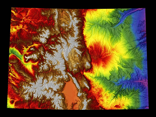
Obvious hint: It’s an elevation map
I’ll post a more helpful hint later if that doesn’t point anybody in the right direction.
I guessed it’s an elevation map and googled UK elevation maps (which it resembles a slimmed down part of) without much joy, and gave up.
CLUES
It could be accurate to say the image has not been cropped.
The image contains a red blue herring.
I’m more interested in the sharp line between red and green. That is an insanely sharp cliff/dropoff and I can’t think of where it might be.
I just looked at relief maps of other planets. Didn’t get me anywhere.
nyet
I had the same thought. Looked at the Cliffs of Moher but doesn’t seem correct.
Is it like Pangea before the plate shifts?
‘Not cropped’ is a really big hint.
Is it something like the blues are deep canyons or mountains and the red is ocean and the green is land above water? Like a coast of California or something? I have no idea I’m probably so far off lol
I don’t expect to be able to find it so just thoughts:
There’s one red/orange area that’s ridiculously smooth there. Maybe a salt flat.
It’s nowhere that exotic. I have spent time there. So has at least one other person who has posted ITT in the past 24 hours.
no it’s an elevation map. Red is usually higher, green and blue is lower. I would guess that the blue area is close to sea level, unless this one is flipped.
Most mountain ranges have foothills, so the transition from green to red is more gradual, with some orange areas. The green-red line suggests high/very sharp cliffs.
Inspiration struck. I think it’s Colorado.
hahah you’re totally right and I am a moron.
jfc i spent 4 years in the shadow of that red blob near the center, you’d think I’d see it.
I got the image from this guy. His river maps are really cool.

